


Lea County Precinct 71, Lea County, New Mexico
About
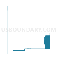
Outline

Summary
| Unique Area Identifier | 623623 |
| Name | Lea County Precinct 71 |
| County | Lea County |
| State | New Mexico |
| Area (square miles) | 546.56 |
| Land Area (square miles) | 546.53 |
| Water Area (square miles) | 0.03 |
| % of Land Area | 99.99 |
| % of Water Area | 0.01 |
| Latitude of the Internal Point | 32.36602040 |
| Longtitude of the Internal Point | -103.57930850 |
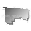
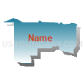
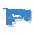
Maps


Graphs
Select a template below for downloading or customizing gragh for Lea County Precinct 71, Lea County, New Mexico


Neighbors
Neighoring Voting District (by Name) Neighboring Voting District on the Map
- Eddy County Precinct 32, Eddy County, NM
- Eddy County Precinct 36, Eddy County, NM
- Eddy County Precinct 37, Eddy County, NM
- Lea County Precinct 62, Lea County, NM
- Lea County Precinct 72, Lea County, NM
- Lea County Precinct 73, Lea County, NM
- Lea County Precinct 74, Lea County, NM
Top 10 Neighboring County Subdivision (by Population) Neighboring County Subdivision on the Map
- Hobbs CCD, Lea County, NM (43,305)
- Carlsbad CCD, Eddy County, NM (33,626)
- Lovington CCD, Lea County, NM (14,624)
- Eunice CCD, Lea County, NM (3,220)
- Loving CCD, Eddy County, NM (2,179)
- Jal CCD, Lea County, NM (2,175)
- Loco Hills CCD, Eddy County, NM (299)
Top 10 Neighboring Place (by Population) Neighboring Place on the Map
Top 10 Neighboring Unified School District (by Population) Neighboring Unified School District on the Map
- Hobbs Municipal Schools, NM (43,019)
- Carlsbad Municipal Schools, NM (33,835)
- Eunice Municipal Schools, NM (3,240)
- Jal Public Schools, NM (2,156)
- Loving Municipal Schools, NM (1,968)
Top 10 Neighboring State Legislative District Lower Chamber (by Population) Neighboring State Legislative District Lower Chamber on the Map
Top 10 Neighboring State Legislative District Upper Chamber (by Population) Neighboring State Legislative District Upper Chamber on the Map
Top 10 Neighboring 111th Congressional District (by Population) Neighboring 111th Congressional District on the Map
Top 10 Neighboring Census Tract (by Population) Neighboring Census Tract on the Map
- Census Tract 7, Eddy County, NM (5,179)
- Census Tract 9, Eddy County, NM (4,917)
- Census Tract 11, Lea County, NM (4,557)
- Census Tract 7.02, Lea County, NM (3,263)
- Census Tract 8, Lea County, NM (3,220)
- Census Tract 8, Eddy County, NM (2,179)
- Census Tract 9, Lea County, NM (2,175)
Top 10 Neighboring 5-Digit ZIP Code Tabulation Area (by Population) Neighboring 5-Digit ZIP Code Tabulation Area on the Map
- 88240, NM (37,149)
- 88220, NM (33,725)
- 88210, NM (17,217)
- 88231, NM (3,238)
- 88252, NM (2,160)
- 88256, NM (1,925)